Rio Dulce is a river in eastern Guatemala linking Lake Izabal, the country’s largest lake, to the Caribbean at Livingston. Its lower course cuts a gorge with forested walls up to 90 m high, a corridor protected as a national park since 1955. At the lake’s mouth stands the Castillo de San Felipe de Lara, a Spanish fort built to stop pirates. For centuries this was the trade route between the colonial interior and the sea; today it is travelled by boat, past Q’eqchi’ Maya villages, manatee reserves and hot springs, usually between the Petén and the Caribbean coast.


What is Rio Dulce?
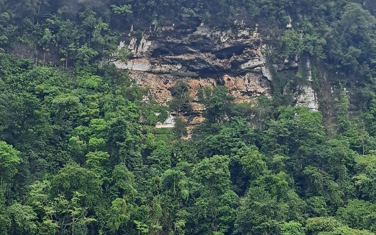
Rio Dulce (“sweet river”) drains Lake Izabal, the largest lake in Guatemala, eastward to the Gulf of Honduras. The town of Fronteras, usually just called Rio Dulce, sits where the main highway crosses the river on a long bridge and serves as the base for boats. Below it the river widens into El Golfete, then narrows into a gorge where limestone walls rise up to 90 m, hung with teak, mahogany and palms.
The whole corridor is the Río Dulce National Park, created in 1955, one of Guatemala’s oldest. It is a place you travel through on the water rather than a town you settle in.
A river with a pirate history
Lake Izabal was colonial Guatemala’s Caribbean back door. Goods from the highlands, indigo, cowhides, silver, were carried down to the lake and out through Rio Dulce to Spanish ships. That made it a target: English and Dutch pirates raided the lake through the 17th century.
The Spanish answer was the Castillo de San Felipe de Lara, a stone fort at the narrows where the river leaves the lake, built and rebuilt from the 1650s to block raiders with a chain across the water. It is restored and open today, the main historical sight on the river. The banks were later settled by Q’eqchi’ Maya moving down from the Verapaces, whose villages still line the lake.
What to do on Rio Dulce
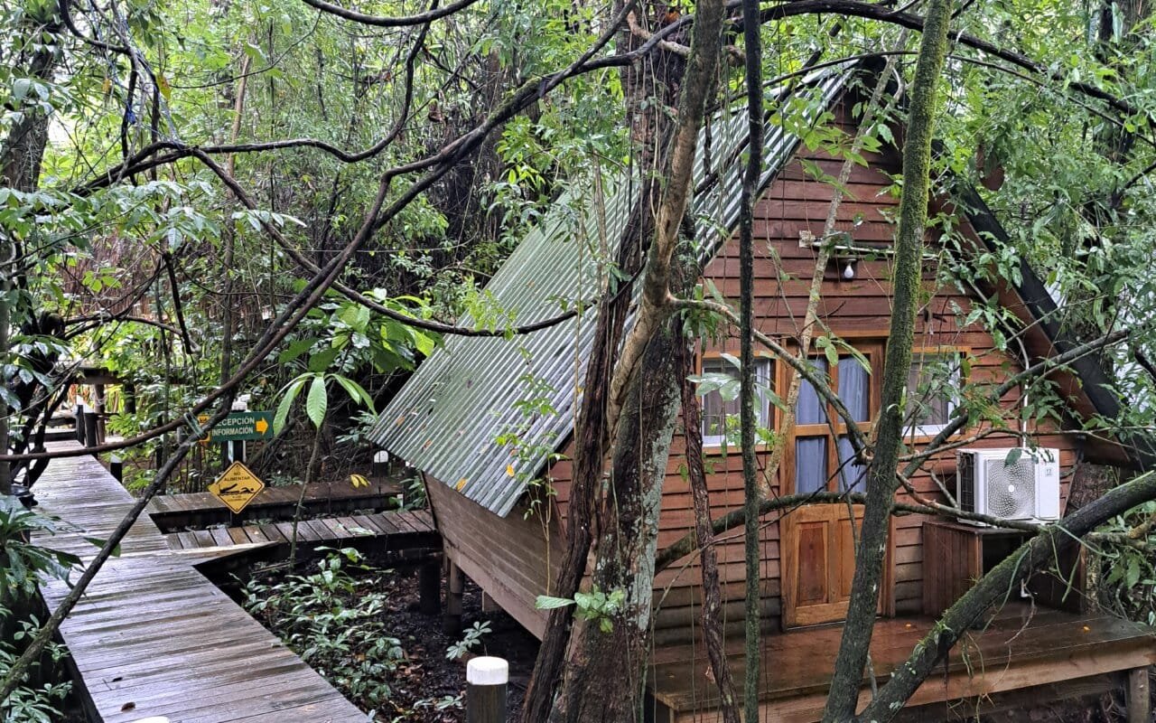
The river is the attraction, and the boat trip between Rio Dulce town and Livingston is the classic way to see it:
- Castillo de San Felipe de Lara: the 17th-century fort at the mouth of Lake Izabal.
- The gorge: the dramatic lower canyon near Livingston, the scenic highlight.
- Biotopo Chocón Machacas: a reserve in El Golfete protecting West Indian manatees and mangrove channels.
- Finca El Paraíso: a hot waterfall on the north shore, where thermal water falls into a cool pool.
- El Boquerón canyon: a narrow limestone gorge paddled by dugout canoe near Rio Dulce town.
Seeing Rio Dulce beyond the boat transfer
Most travellers ride straight through to Livingston. Slowing down shows the living river:
- Go out at dawn, when herons, cormorants and kingfishers work the mangroves and the water is glass.
- Visit a Q’eqchi’ community project such as Ak’ Tenamit, which runs health and education work with riverside villages and welcomes respectful visitors.
- Swap the lancha for a kayak in the quieter side channels of El Golfete.
- Stop at a lakeside village rather than only the marina, to see how river families live between fishing and farming.
The river is the hinge between jungle and sea: it links Flores and the Petén to the north with the Caribbean town of Livingston downstream, and inland to Semuc Champey.
Where Rio Dulce fits in a trip
Rio Dulce is a connector, which is its strength: it turns the drive between the Petén and the coast into a river journey, and gives a first taste of the Caribbean, Q’eqchi’ side of Guatemala. It appears in our itineraries that join the north to the sea:
- Wonders of Guatemala: the headline route, Caribbean included.
- Antigua to Tikal: pairs the Maya north with the coast.
- Nature immersion: for the reserves and wildlife.
See all our regions of Guatemala.
How to get to Rio Dulce
| From | Distance | Time | Notes |
|---|---|---|---|
| Flores (Petén) | ~210 km | 3 h 30 to 4 h | Common stop between Tikal and the coast |
| Guatemala City | ~280 km | 5 h to 6 h | Via the Atlantic highway (CA-9) |
| Lanquín / Semuc Champey | ~130 km | 4 h to 5 h | Links the Verapaces to the coast |
| Livingston | ~30 km by river | 45 min to 1 h | By boat only; no road to Livingston |
Many travellers ride the boat one way and continue from Livingston.
FAQ: Rio Dulce
What is Rio Dulce in Guatemala?
A river linking Lake Izabal, Guatemala’s largest lake, to the Caribbean at Livingston. Its lower course runs through a forested gorge inside the Río Dulce National Park, travelled by boat.
How do you get from Rio Dulce to Livingston?
By boat only, about 45 minutes to an hour down the river. There is no road to Livingston, so the lancha is the sole way in and out.
What is the Castillo de San Felipe?
A 17th-century Spanish fort at the entrance of Lake Izabal, built from the 1650s to stop English and Dutch pirates raiding the lake. It is restored and open to visitors.
Can you see manatees on Rio Dulce?
The Biotopo Chocón Machacas reserve in El Golfete protects West Indian manatees, though they are shy and sightings are not guaranteed. The mangrove channels and birdlife are the main draw.
Why was Rio Dulce historically important?
It was colonial Guatemala’s route to the Caribbean: highland goods were shipped down Lake Izabal and out to sea, which is why it was fortified against pirates.
How long do you need at Rio Dulce?
Often just the boat trip between Rio Dulce town and Livingston, with an optional night to add the hot waterfall, the fort or a reserve. It is usually a link between the Petén and the coast.
Last updated: October 2026
About the author
Fernanda Ríos is co-founder of Terra Guatemala, a local travel agency based in Antigua. She builds the eastern routes that thread the Petén, Rio Dulce and the Caribbean coast.
Sources
- Río Dulce National Park (CONAP)
- INGUAT, Instituto Guatemalteco de Turismo
- Historical record of the Castillo de San Felipe
- Field observations, Terra Guatemala, 2026